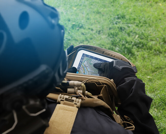
Despite the digitisation of situation assessment through the use of command & control systems, classic analogue map material is still additionally used in command posts. This is because it provides an intuitive overview of the overall situation as well as details, therefore supplementing the digital, near-realtime situation display.
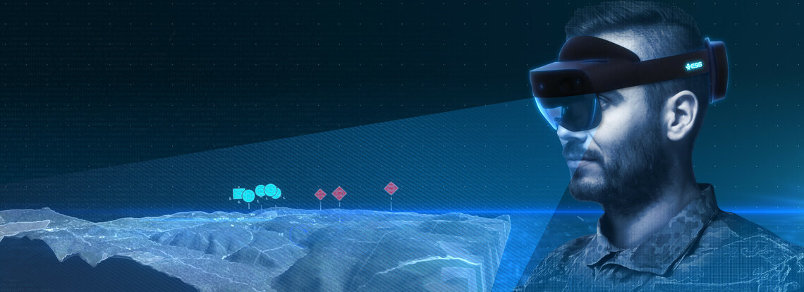
ESG's Augmented Common Operational Picture (ACOP) brings the advantages of these two worlds together in a future-oriented solution - an interactive 3D visualisation of the battlefield for a complete overview as well as in detail for better orientation and assessment.
ACOP uses Microsoft HoloLens glasses to enable a realistic 3D terrain display. The displayed area is projected into the room in any size (up to 10x10 metres). The basis for the display is provided by geospatial and elevation data, which are provided by a geographical information system (GIS). Soldiers can then assess the terrain – e.g. for cover, attack or route guidance – based on real terrain features.
In connection with a command & control system, situation information is displayed as tactical symbols in near-realtime. Operators and decision-makers can follow the current situation development directly in the 3D terrain and therefore quickly plan and make appropriate decisions.
The situation display is not limited to land forces. All aircraft are shown to scale for airspace coordination. Users can thus intuitively determine and evaluate the airspace situation.
Joint situation briefings can be carried out interactively by networking several HoloLens glasses. The participants can access and interact with one and the same ACOP - even spatially separated from one another.
The TARANIS® Information Mediation Service enables the connection of any national and international command & control systems with data exchange via corresponding military standards.
-
Intuitive assessment of the terrain and visibility through 3D display of the terrain
-
Situational awareness of different dimensions with simultaneous representation of land forces and a true-to-scale airspace situation
-
Joint interactive briefing with the 3D model - even if there is a spatial separation
-
Faster and more precise decision-making support thanks to intuitive understanding of the terrain and situation
- Connection of standard map servers with TMS or WMT protocol, such as ESRI or Geoserver
- Display of any map data: OSM, PCMAP, Ortho etc.
- Elevation model display: DTED, SRTM, DEM
- UTM grid
- Direct all-round view of the incline and slope of the terrain
- Direct view of streets, paths, buildings and vegetation
- Assessment of line of sight and radio coverage
-
Real-time display of tactical symbols according to MilStd2525, APP6
-
True-to-scale airspace situation including airspace violations, flight routes and collision risks
- Size adjustable up to 10x10 metres
- Free positioning in the room
- Intuitive operation with finger, hand and arm gestures in near and far range (</> 50cm away from the body)
- Visual and acoustic feedback for all user actions
- Selection of map section, map type and zoom level
- Increase/decrease elevation display
- Set marker arrow
- Object selection and centring on the map
- Change object position via drag & drop
- Centre on hotspot
- Synchronisation of interactions with all HoloLens participants
-
Data exchange with national command & control systems (e.g. FüInfoSys Heer, ADLER) or international systems (e.g. LC2IS, SitaWare)
-
Supports military standards: NVG, NFFI, MIP BL2 und BL3.1


